


Share
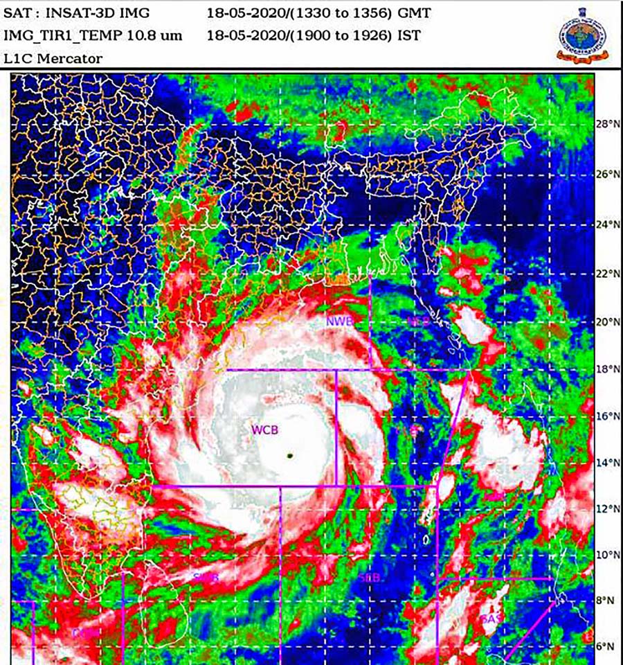
Kolkata, May 19 (PTI): The super cyclonic storm 'Amphan' in west-central Bay of Bengal is likely to weaken into an 'extremely severe cyclonic storm' by noon on Tuesday, the Met department said here.
The system, which was situated 670 km south-southwest of Digha in West Bengal, is very likely to move north-northeastwards across northwest Bay of Bengal, and cross West Bengal-Bangladesh coasts in the afternoon or evening of Wednesday as a 'very severe cyclonic storm', the Met department said.
The weatherman said that 'Amphan' is expected to cross West Bengal-Bangladesh coasts between Digha in West Bengal and Hatiya islands in Bangladesh on May 20 as a very severe cyclonic storm, after losing some steam as it approaches landfall, with a maximum sustained wind speed of 155 to 165 kmph gusting to 180 kmph.
Gale wind speeds reaching 240 to 250 kmph were prevailing over west-central and adjoining east-central Bay of Bengal, the Met office said, adding, it will gradually reduce to 200 to 210 kmph gusting to 230 kmph by Tuesday evening.
The Met department, which has issued an "orange message" for West Bengal, warned of extensive damage in Kolkata, Hooghly, Howrah, South and North 24 Parganas and East Midnapore districts.
There is likely to be disruption of rail and road link at several places, uprooting of communication and power poles and extensive damage to all types of 'kutcha' houses, the weatherman said.
There is also likelihood of massive harm to standing crops, plantations and orchards, the Met office said.
Wind speeds along and off the coastal areas of West Bengal will reach 45 to 55 kmph with gusts of 65 kmph from Tuesday afternoon, and will gradually increase becoming gale wind speeds reaching 75 to 85 kmph with gusts up to 95 kmph from May 20 morning along and off districts of North and South 24 Parganas, East and West Midnapore, Kolkata, Howrah and Hooghly, Regional Met Director G K Das said.
"It will gradually increase thereafter becoming 110 to 120 kmph gusting to 130 kmph over West Midnapore, Howrah, Hooghly, Kolkata and wind speeds of 165 to 175 kmph gusting to 195 kmph over the districts of North and South 24 Parganas and East Midnapore from the afternoon to night of May 20," Das said.
Under its impact, the coastal districts of Gangetic West Bengal, including North and South 24 Parganas, Kolkata, East and West Midnapore, Howrah and Hooghly are likely to experience light to moderate rain at many places with heavy downpour at isolated places on Tuesday, he said.
On Wednesday, rainfall will occur in many places over the districts of Gangetic West Bengal, with extremely heavy rain at one or two places in Kolkata, Howrah, East Midnapore, North and South 24 Parganas and Hooghly districts, he said.